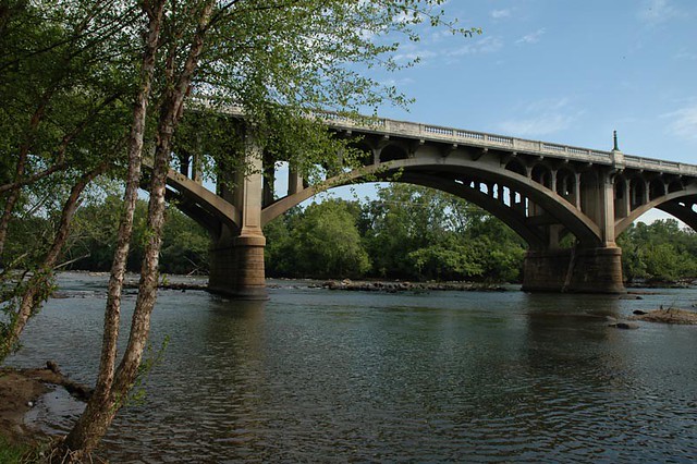
The Flickr Congareeriverbridge Image Generatr

About

This page simply reformats the Flickr public Atom feed for purposes of finding inspiration through random exploration. These images are not being copied or stored in any way by this website, nor are any links to them or any metadata about them. All images are © their owners unless otherwise specified.

This site is a busybee project and is supported by the generosity of viewers like you.

U.S. Route 21, U.S. Route 176, and U.S. Route 321 go across the Congaree River, across the Lexington/Richland county line. by Tim Kiser

© Tim Kiser, all rights reserved.

U.S. Route 21, U.S. Route 176, and U.S. Route 321 go across the Congaree River, across the Lexington/Richland county line.

I was out here taking a walk, being weird, having fun, listening to music, taking pictures.

-----------------------

In Cayce, South Carolina, on January 2nd, 2024, a view to the east from the south side of the McMillan Bridge across the Congaree River (built in 1953), on Knox Abbott Drive (U.S. routes 21, 176, and 321). The city of Columbia is across the bridge.

-----------------------

Getty Thesaurus of Geographic Names terms:
• Cayce (2095481)
• Columbia (7013641)
• Congaree (river) (1123023)
• Lexington (county) (2001756)
• Richland (county) (2001764)

Art & Architecture Thesaurus terms:
• boundaries (300055590)
• road bridges (300007891)
• sidewalks (300003893)
• skylines (300075416)
• streetscapes (300249570)
• winter (300133101)

Wikidata items:
• 2 January 2024 (Q69307033)
• 1950s in transport (Q105659203)
• 1953 in transport (Q124262242)
• 2023-24 North American winter (Q123171053)
• city limits (Q3308569)
• Columbia-Sumter-Orangeburg, SC Combined Statistical Area (Q124152409)
• Congaree River (Q2992976)
• county line (Q97644453)
• January 2 (Q2151)
• January 2024 (Q61312882)
• Middle Atlantic coastal forests (Q6841214)
• Midlands (Q2957044)
• Sand Hills (Q105800115)
• Southeastern Plains (Q70928628)
• U.S. Route 1 (Q406204)
• U.S. Route 176 (Q4296876)
• U.S. Route 321 (Q4296949)

Library of Congress Subject Headings:
• Bridges—South Carolina (sh2002009819)
• Roads—South Carolina (sh2011000580)

Troll View by Lucky Guitar

© Lucky Guitar, all rights reserved.

Troll View

Congaree River Bridge, Gervais Street, Columbia, South Carolina by Thad Roan - Bridgepix

© Thad Roan - Bridgepix, all rights reserved.

Congaree River Bridge, Gervais Street, Columbia, South Carolina

Bridgepixing the Congaree River Bridge, carrying Gervais Street, Columbia, South Carolina. This arch bridge, built in 1927, is also known as the Jefferson Davis Highway Bridge or the Gervais Street Bridge. Columbia is the capital of South Carolina and home of the University of South Carolina. Additional Bridge Photos and a Bridge Blog at www.Bridgepix.com.

The Congaree River is a short but wide river in South Carolina in the United States; It flows for only 47 miles (78 km). The river serves an important role as the final outlet channel for the entire Lower Saluda and Lower Broad watersheds, before merging with the Wateree River just north of Lake Marion to form the Santee River.

It is formed in Columbia by the confluence of the Saluda and Broad rivers near the Piedmont fall line. It serves as part of the boundary between Richland, Calhoun, and Lexington counties. The only cities near the river are Columbia on the east, and Cayce and West Columbia on the west.

Despite the vast bottomland swamp below Columbia, the Congaree is navigable along much of its length at high water by barge traffic, which comes upriver from the Port of Charleston (approximately 100 miles (167 km)) through the Santee-Cooper Lakes to within 5 miles (8 km) of the fall line. The Congaree National Park, one of the main recreational attractions of the river, is located about halfway down the river's course. The 22,200 acre (90 km²) park contains some of the last remaining old growth bottomland hardwood forest in North America. Recreational opportunities include hiking, biking, bird watching, botanical interests, and canoeing.

The river's name comes from the Congaree Indians who used to live along it. (Wikipedia)

Congaree River Bridge, Gervais Street, Columbia, South Carolina by Thad Roan - Bridgepix

© Thad Roan - Bridgepix, all rights reserved.

Congaree River Bridge, Gervais Street, Columbia, South Carolina

Bridgepixing the Congaree River Bridge, carrying Gervais Street, Columbia, South Carolina. This arch bridge, built in 1927, is also known as the Jefferson Davis Highway Bridge or the Gervais Street Bridge. Columbia is the capital of South Carolina and home of the University of South Carolina.

The Congaree River is a short but wide river in South Carolina in the United States; It flows for only 47 miles (78 km). The river serves an important role as the final outlet channel for the entire Lower Saluda and Lower Broad watersheds, before merging with the Wateree River just north of Lake Marion to form the Santee River.

It is formed in Columbia by the confluence of the Saluda and Broad rivers near the Piedmont fall line. It serves as part of the boundary between Richland, Calhoun, and Lexington counties. The only cities near the river are Columbia on the east, and Cayce and West Columbia on the west.

Despite the vast bottomland swamp below Columbia, the Congaree is navigable along much of its length at high water by barge traffic, which comes upriver from the Port of Charleston (approximately 100 miles (167 km)) through the Santee-Cooper Lakes to within 5 miles (8 km) of the fall line. The Congaree National Park, one of the main recreational attractions of the river, is located about halfway down the river's course. The 22,200 acre (90 km²) park contains some of the last remaining old growth bottomland hardwood forest in North America. Recreational opportunities include hiking, biking, bird watching, botanical interests, and canoeing.

The river's name comes from the Congaree Indians who used to live along it. (Wikipedia)