
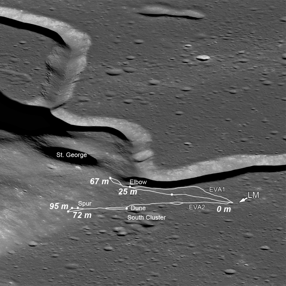
“This is a relief map of the landing site made by the U. S. Army Photographic [Topographic] Command. The landing site is here several kilometers east of Hadley Rille. The Apennine Mountains are off the relief map further off to the east. There five objectives at the landing site: The first and primary objective is to sample the mountain front. At this particular place the Apennine Mountains for a slight bow to the west so that the mountains which are further off to the east here come around and we are able to sample south of the landing site some of the Apennine front material. That is the primary objective of the mission. The secondary objective of the mission is to study the rille itself. The sinuous, meandering rilles on the moon are an enigma at this time. The third objective is to look at the mare itself. We are now quite a bit further north than any of the other mares we visited. This is in particular a very dark mare. It may be one of the youngest mares that we can visit on the moon. The fourth objective is the north complex. The most probable interpretation at this time is that this is a volcanic complex. There are other interpretations possible. The sampling will take place at several points in the north complex. And the final objective is this cluster of craters southeast of the landing site, and these are believed to be secondaries from the large craters, Autolycus and Arostyllus [Aristillus], which are much further to the northwest within the Mare Imbrium itself.”
With the above task list, it’s a testament to David Scott’s professionalism, commitment and dedication to becoming an astute student & practitioner of geology/geological observation. Not that I expect anyone to do it, but if you watch - listen actually - to his commentary & observations while on moon, it’ll blow you away, especially if you’re a Geologist. I’m sure Jack Schmitt was proud. And not to slight Irwin, but Scott’s efforts were singularly exceptional.
This photograph is really cool, in that it’s actually a photograph of an actual relief map, (with EVA traverses superimposed). A pretty good one at that. Then again, it had to be, after the POS the Army crapped out for Apollo 13/14. I’m surprised NASA gave them another/continuing opportunity.
One of the physical relief maps is seen here:
dygtyjqp7pi0m.cloudfront.net/i/29546/25729474_2.jpg?v=8D3...
Credit: RR Auction/icollector.com
It sold for something like a bajillion dollars, +/- a couple of billion.
To me, this landing site was by far the most spectacular visually as well.


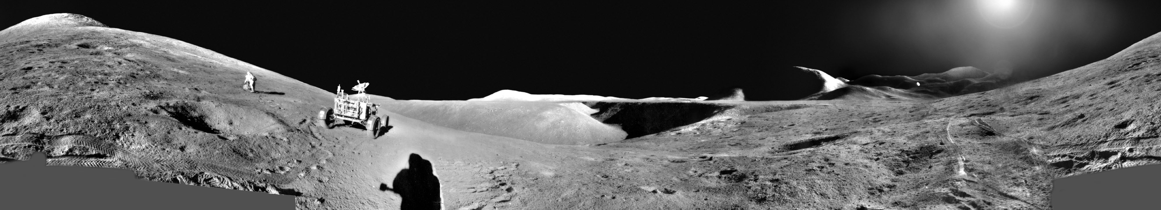
_v_bw_o_n (ca. 1971, unnumbered GAC photo, LRV dep 05, 71-H-983 eq)")
")
")
")

")
")
")
")
")
")
")
")
")
")
")
")
")
")